Days 29-32: Alaska!
- Karen Derrick-Davis
- May 18, 2025
- 7 min read
Updated: May 18, 2025
Wildlife Bingo
Black Bears
Caribou
Rock Ptarmigan
Swans
Dahl Sheep
Marmot?
Hare
Highlights
White Pass
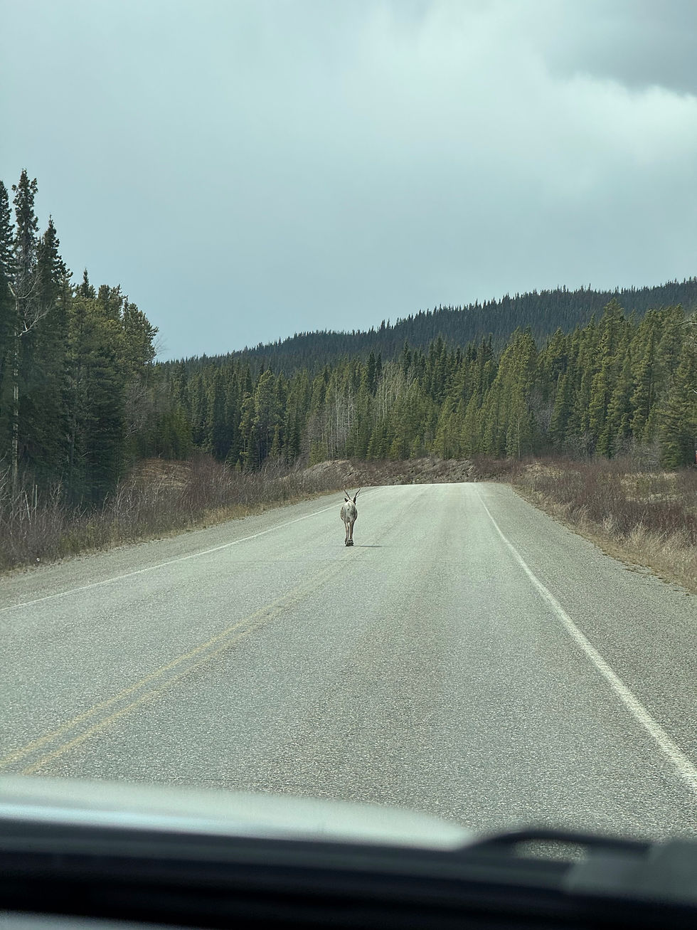
Caribou walking yellow line in highway
Carcross culture center
Elias mountain range
the many very blue and green mountain lakes
Hiccups
Was all prepared with dog documents, but didn’t have them in hand at US border. Guard asked if I had completed the CDC form on line. I assured him I had, he reluctantly let us through (turned out the forms were in the seat pocket behind me…)
No room on the ferry from Skagway to Haines; had to retrace route and drive around instead.


Seeing bears and caribou on the highway never gets old. These highways are pretty empty of cars. We learned from the visitor center that wildlife comes to the highway in the spring because of the green shoots that grow along the roadway, when the vegetation in the forest has yet to sprout.

The expanses are just SO VASTE! No human development, no advertising billboards between towns except within a couple kilometers of town, very few distance signs between towns (makes for a lot of guessing, since there is little cell service as well), virtually no developed recreation (ski lifts, river rafting, ziplining, etc – the things we see in Colorado). If you want to experience the wilderness here, you have to be a backcountry kind of person. To ski, you have to be shuttled up by snowmobile or dropped from a helicopter.
People are sparse, too. All the towns, so far, are smaller than we expect them to be. Most are just a wide spot in the road with maybe one gas pump (thank goodness).
Birding at 10 pm
It never stops to amaze us how light it is at 10 pm! It doesn’t even look like dusk at that hour – more like a cloudy afternoon until about 11pm when the “evening” light begins. Last night at 10pm, I even heard birds! I started wondering about the lives of birds and mammals up here. Do they stay “awake” – have daylight behavior – as long it is light? I know that my behavior changes. We are staying up later and we are surprised how late it is when we look at our watch. My body does start to feel tired and a little sleepy at the “normal” time, but at the same time, I feel awake and not ready to go to sleep.
Watson Lake to Squanga Lake
Day 29: This day was our first truly rainy driving day – though only intermittent, it did actually rain more than a sprinkle on and off. The rain did not keep the caribou away. We saw several and one guy casually walked down the middle of the road – in no hurry to let us pass.
We headed for a small campground on the map, hoping it was actually there and the gates were open. Once again, we found a beautiful mostly-empty government campground with free firewood and sites on a lake.
Squanga Lake to Skagway, Alaska (the panhandle)
Day 30: We continue to buy gas every chance we get. We gassed up at Carcross and stopped at the tribal government offices to see their cultural display. It was very well-done and informative. The Tlingit and Tagish tribes have been fishing and hunting here continuously for over 9,000 years. Recently, some ice patches (smaller than glaciers and in depressions, so they do not move down the mountain) have started to melt and reveal artifacts like 1000-year-old caribou dung and a very intact hunting dart.


Skagway is a small town in the Alaskan panhandle and a destination for Inner Passage cruiseships. To get there by land requires a drive over White Pass and a stop at US customs at the snowy top. White Pass, though only at an elevation of 2,864 feet felt like a 10,000-foot Colorado pass. In May, it is a very snowy, frozen wintery wonderland. The guard at this lonely border had a scowl and bravado as he questioned us about weapons, eggs (bird flu), citrus, liquor, and the dog.
Dang! I forgot to pull out the dog's folder of paperwork and I wasn't sure where it was... He was annoyed, but let me pass after I assured him I had completed the CDC form on line. He also didn't seem to want to be bothered with having us toss out our 4 eggs. He gave a heavy sigh and said we could go.


Skagway is a cute town, but its charm wears off quickly. All the shops we saw were catering to the cruiseshippers -- gourmet popcorn, restaurants, high-end jewelry stores. The daily influx of hundreds of cruise ship passengers must provide a kind of weird experience for the locals here. A deluge of people during the day and rolled-up sidewalks by 7pm. We saw three massive cruise ships (one, the Caribbean Princess seemed a bit out of place!) docked the day we arrived.


The town of Skagway was established (in the US territory of Alaskan) as the jumping off place for eager gold miners during the Yukon Gold Rush. Gold rushers here are called “stampeders.” From Skagway, the stampeders still had a long way to go – 500 miles over White Pass into Canada. The Gold Rush here was fast, furious and quickly over. Because… , the Canadian government eventually required US stampeders to have one ton of supplies before they were allowed to cross the border at White Pass.

Our plan was to stay two nights in Skagway and then ferry out to Haines – the first boat ride of our trip! But, we had to adjust our plans… Unfortunately, we had not made a reservation ahead of time and when we called on Thursday to book for Friday, there was no room for us. That one slipped by us in the planning process – darn! Oh well, we decided to drive out of Skagway a day early and continue north via the land route.
Back to the Yukon Territory: Skagway to Destruction Bay, Yukon
Day 31: The Canadian guard we met on the way back across the White Pass border was the complete opposite of the US guard we met the day before. This guy was friendly, chipper, informal...though he asked the standard Canadian border guard question: “You have guns at home, right?” Again, our answer of, "No," was met with a quizzical look.

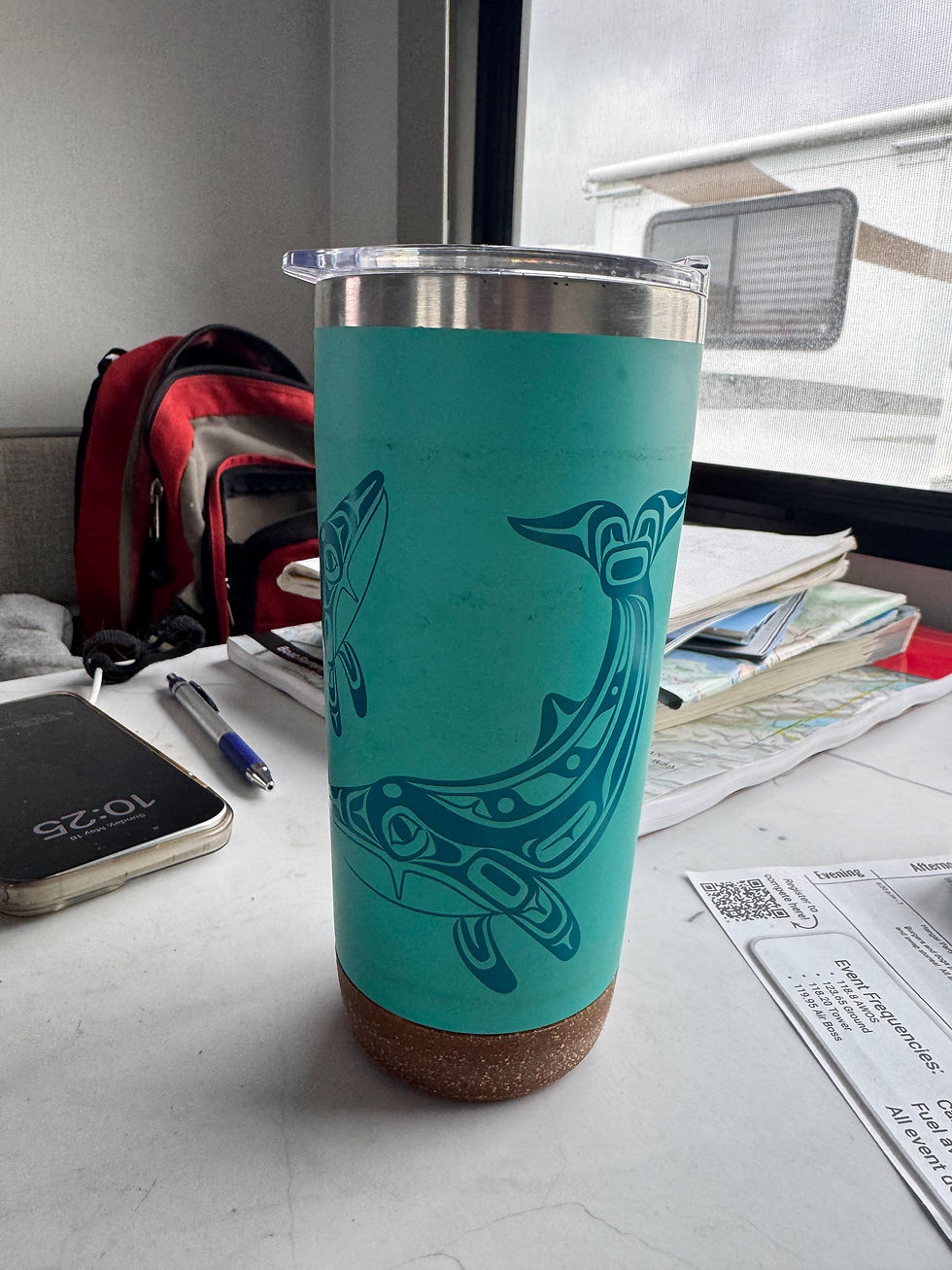
This route took us through Whitehorse, which we had not planned to visit until the trip back home. I really liked this town – a real town with real people, not just tourists and those supporting the tourist trade. We stopped by a bookstore recommended to us, Mac’s Fireweed. It was an eclectic store with more than books. The Midnight Sun Emporium next door had items with native art designs with the specific artist and their tribe affiliations identified. I bought myself a travel coffee mug with a humpback whale design by Gordon White of the Haida tribe. I love humpback whales and the memories I have of seeing them in the ocean.
We continued on to Haines Junction and then to Kluane Lake, the largest lake in the Yukon.


A few miles after seeing a black bear cross the road, we found another awesome Yukon campground, Congdon Creek near Kluane Lake -- again with free firewood that burned great. At this campground, we wore our bear bells (warning bells keep from startling them -- not dinner bells to announce a meal coming down the path!) and carried bear spray around the campground.


Alaska Highway into Alaska!: Destruction Bay to Deadman Lake, AK
Day 32: Continuing along Kluane Lake, we saw our first Dahl Sheep grazing on the hillside. At the southeast end of the long lake is a large riverbed that used to be covered by the Slim's River (still there, but is very small). Kluane Lake emptied into this river with its water eventually flowing into the Pacific Ocean, initially. Then a glacier crossed the river and cut off the lake’s drainage. It filled so much that it eventually overflowed on the other end and began to flow in the opposite direction through the Yukon River basin towards the Bering Sea. By the time the glacier receded, the direction of the river was permanently altered! Now the water travels hundreds of miles farther to join the Bering Sea than it did to meet the Pacific Ocean.

We stopped at Edith River to pan for Yukon gold -- no luck. I did see a bald eagle grab a stick from the riverbed and take to its nest, though!


We crossed the border again, today. Our US border guard was unexpectedly friendly and chipper! He was not worried about the dog's papers. I waved them at him and he waved me off. He asked the standard questions and then with a cheery, "Welcome Home!" we were on our way.
At Deadman Lake (why use this name???) in Tetlin National Wildlife Refuge, we found an empty campground (except for the host). We picked the lovely site 4, close to the lake. A bit later, another camper showed up. J, a woman about our age, traveling alone from Florida(!) to work in Palmer, Alaska for the summer. She is the second person we have met who was on their way to a summer gig in Alaska. The other guy was on his way to work at the Valdez KOA as a handyman. As we chatted with J, we all marveled at finding a donation-based campground with free firewood in the US -- not something either of us had seen before.
Also got several birding "lifers," here. Thanks to the Merlin app for identifying them.


After setting up, we drove over to a rockhounding place mentioned in our book. Found some pretty ones, but not the cache described in the book. The evening ended with some rainy sprinkles, but still managed to have a nice meal cooked over the fire.

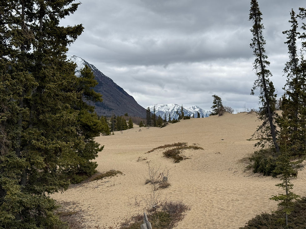
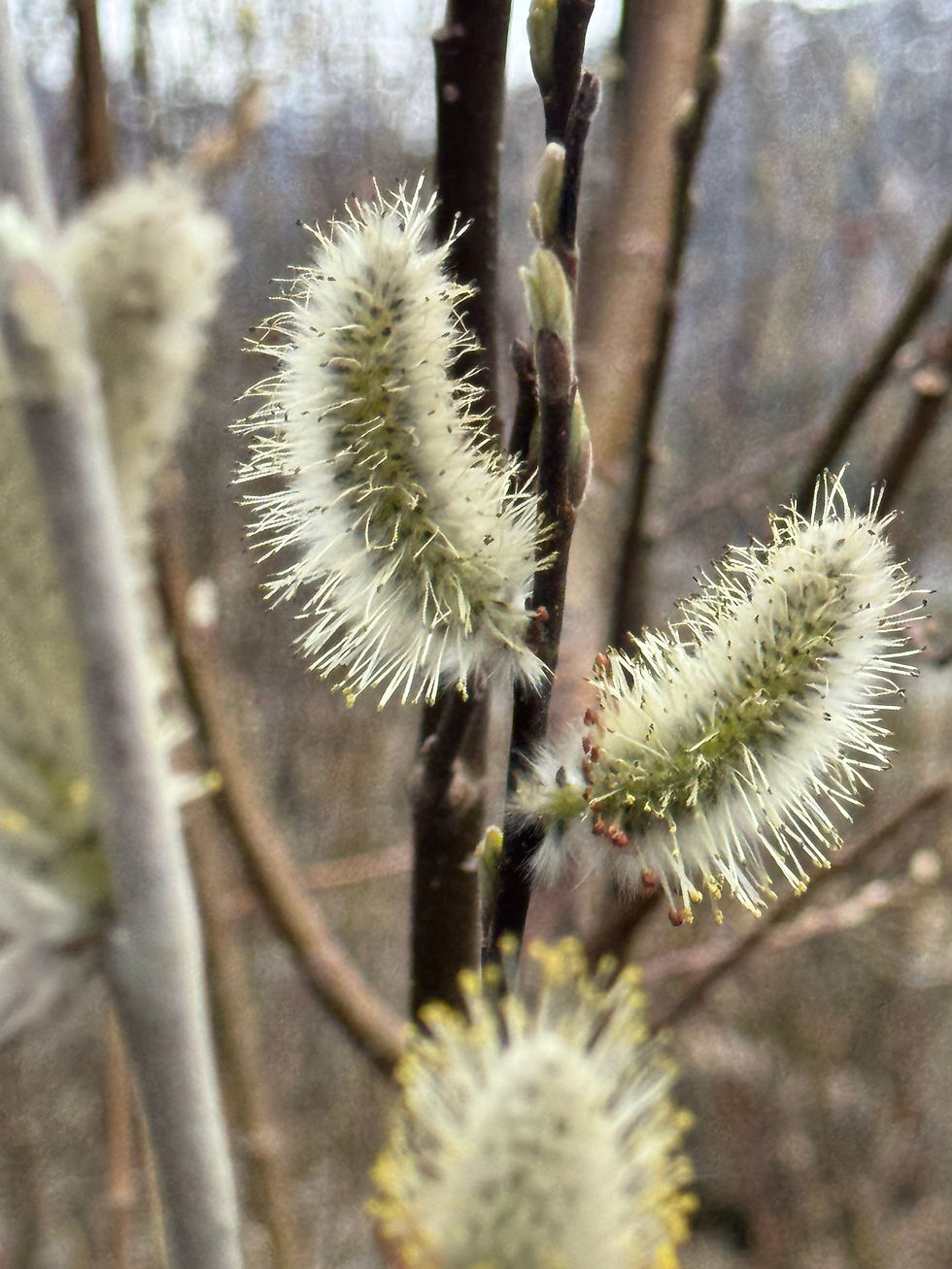
Here are a few more photos from the day's drive.


I enjoyed this post, particularly the birds at the end.
More beauty!!